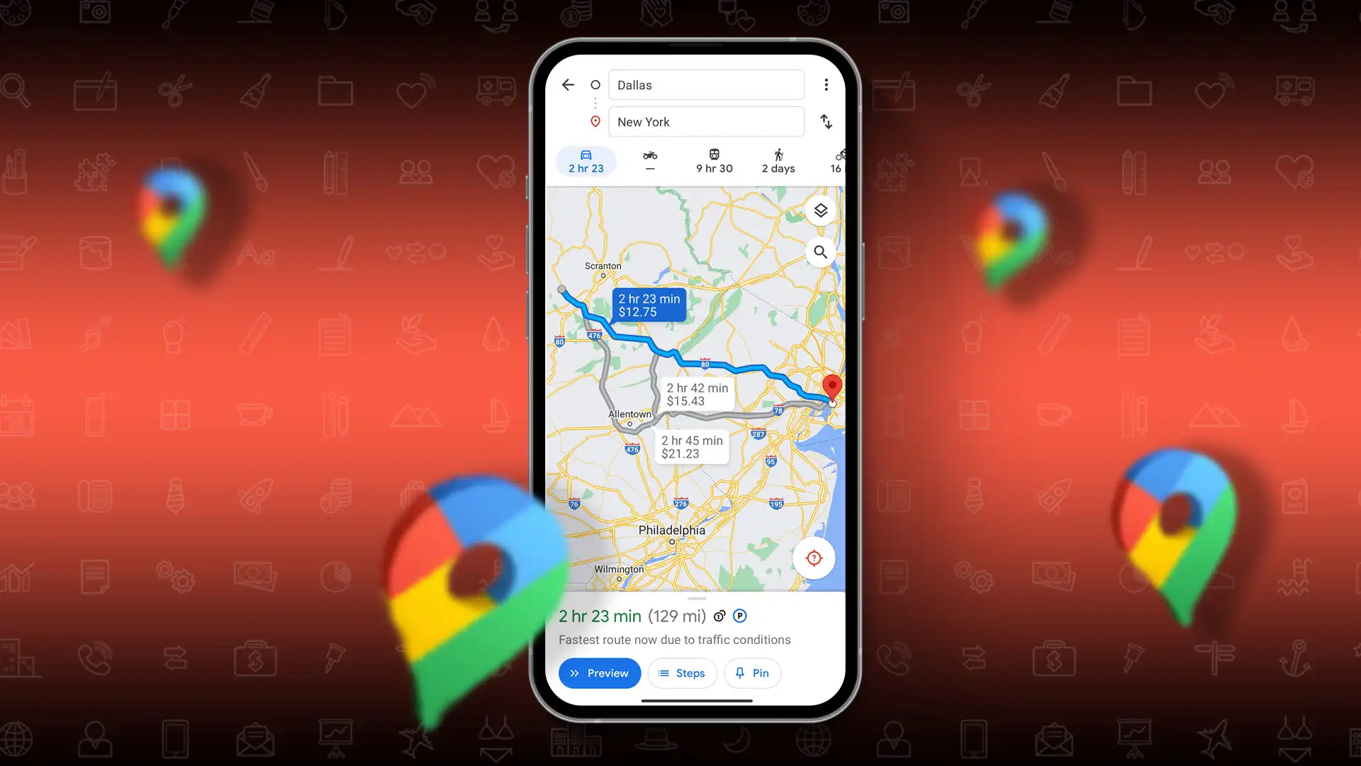
- To check toll prices: Open Google Maps > Tap your profile picture > Select Settings > Choose Navigation settings > Turn on the “See toll pass prices” option.
- To avoid toll roads: Tap on your route > Tap on “Tolls” > Select “Driving options” > Enable any or all of the three options provided.
Planning a road trip and curious about the toll costs? No worries! Google Maps has introduced a feature called “Toll Price” that shows you the toll prices for your journey. This feature helps you plan your budget for the trip. Let’s dive into how you can use this feature.
This guide will explain how to see Toll Prices on Google Maps. Currently, this feature is available in four countries – the U.S., India, Japan, and Indonesia. If you’re residing in these countries, you can use this feature to plan your trips more efficiently.
How to Check Toll Prices on Google Maps
To see toll rates on Google Maps, follow these steps:
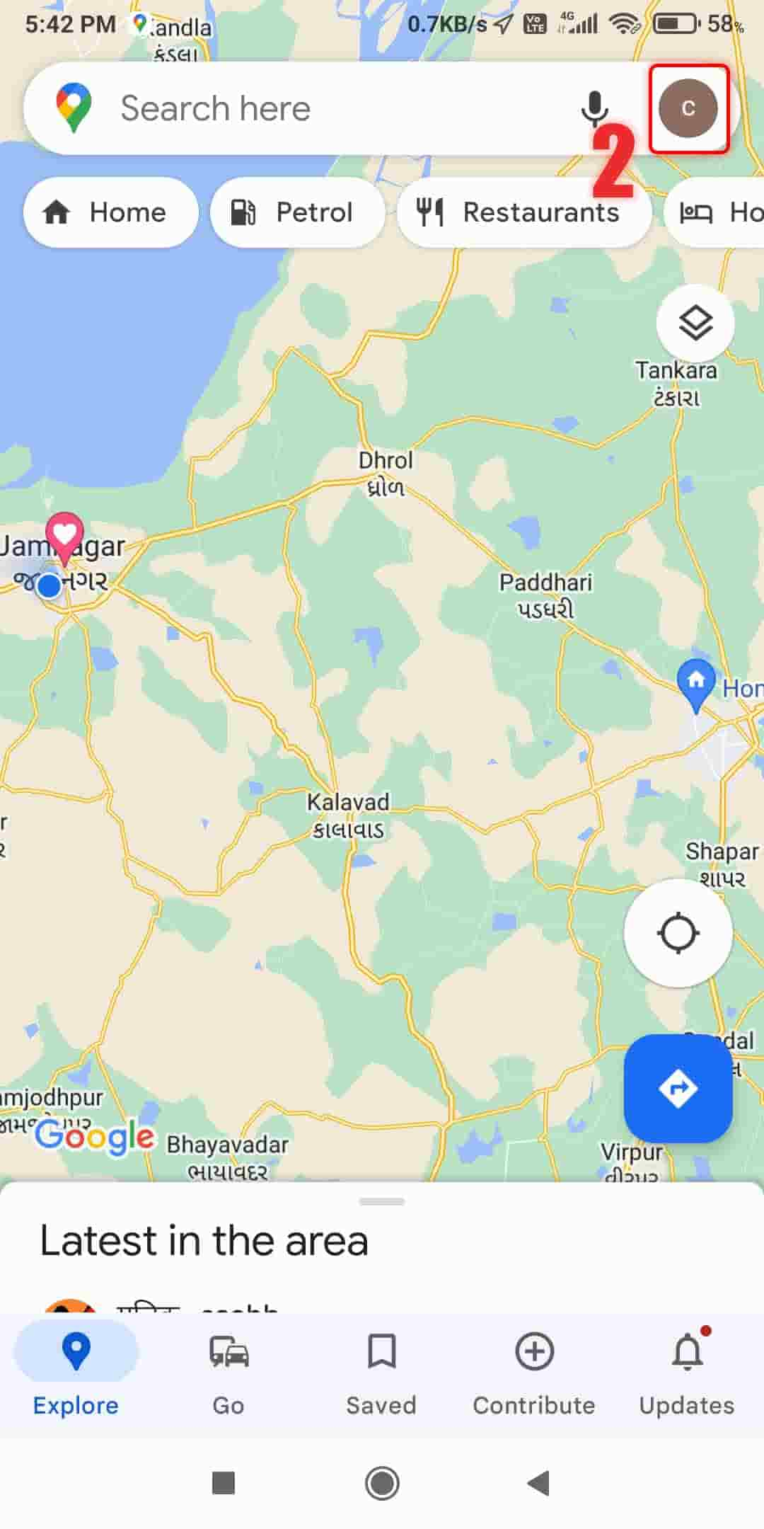
Step 1: Open Google Maps on your mobile device and tap on your profile picture in the top right corner of the screen.
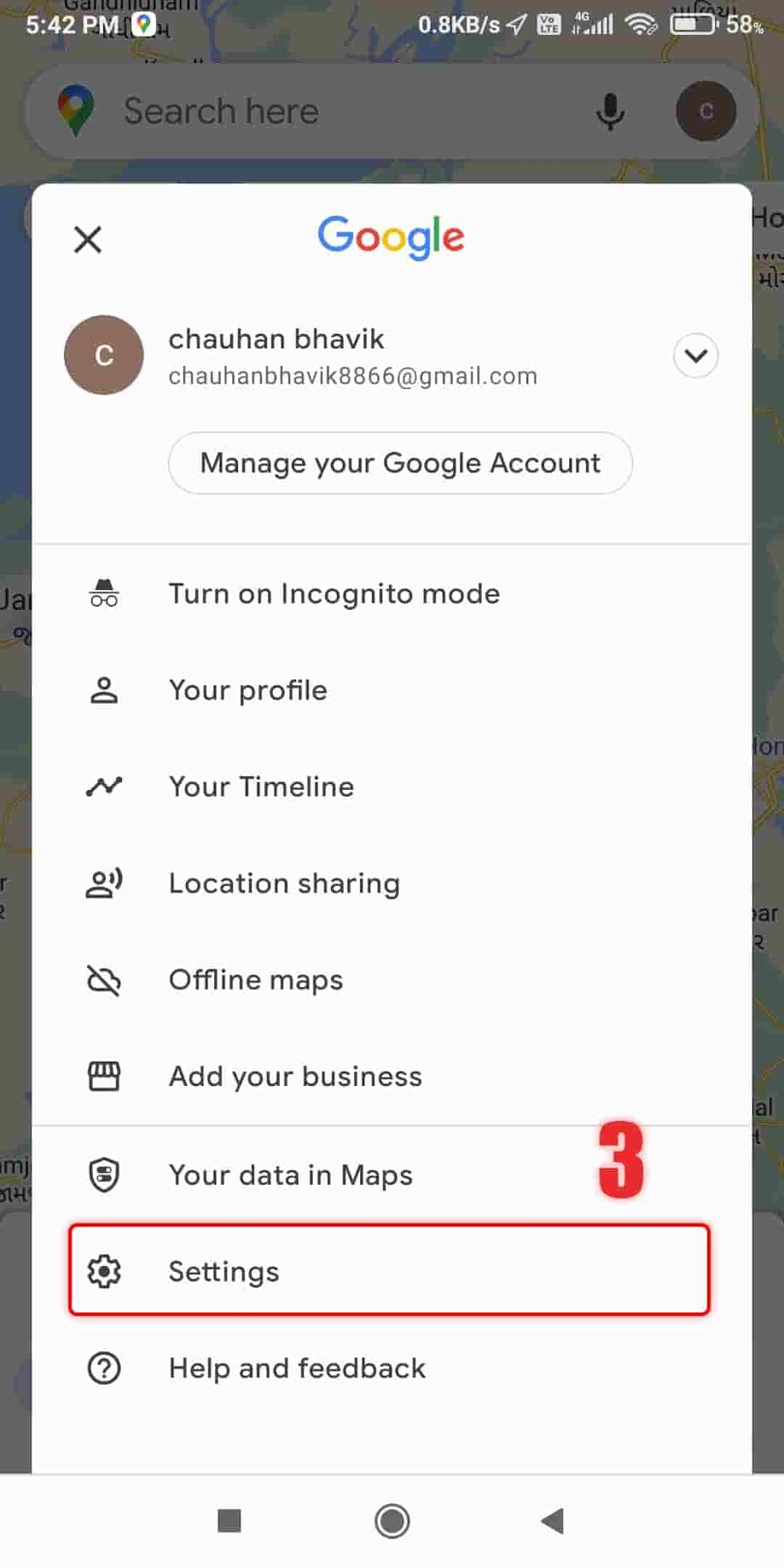
Step 2: Choose “Settings” from the dropdown menu.
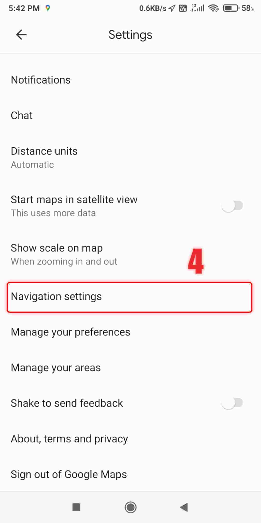
Step 3: Scroll down and tap on “Navigation settings.”
Step 4: Find the “Toll price” section and switch on the “See toll pass prices” toggle.
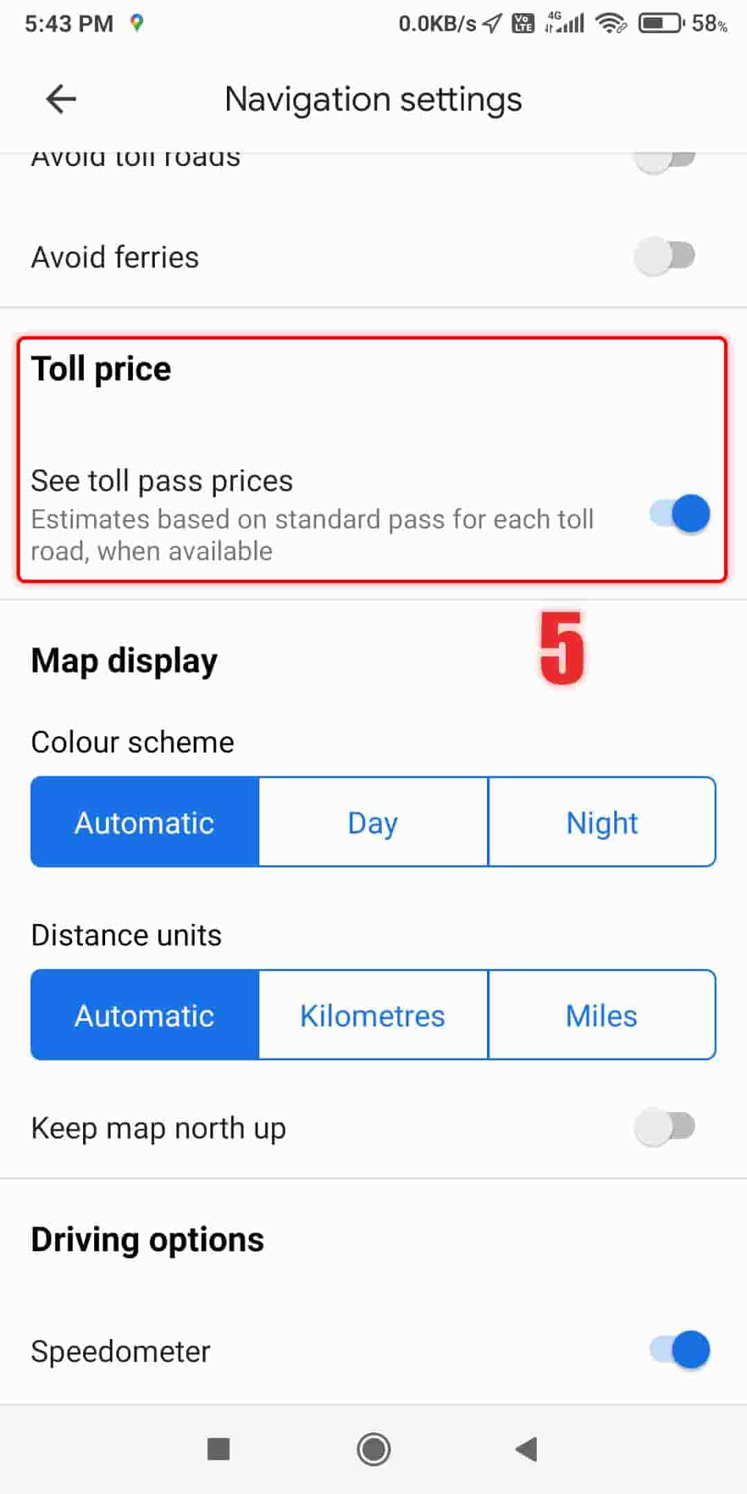
Step 5: Once activated, you’ll be able to see toll prices along with the directions and routes on Google Maps.
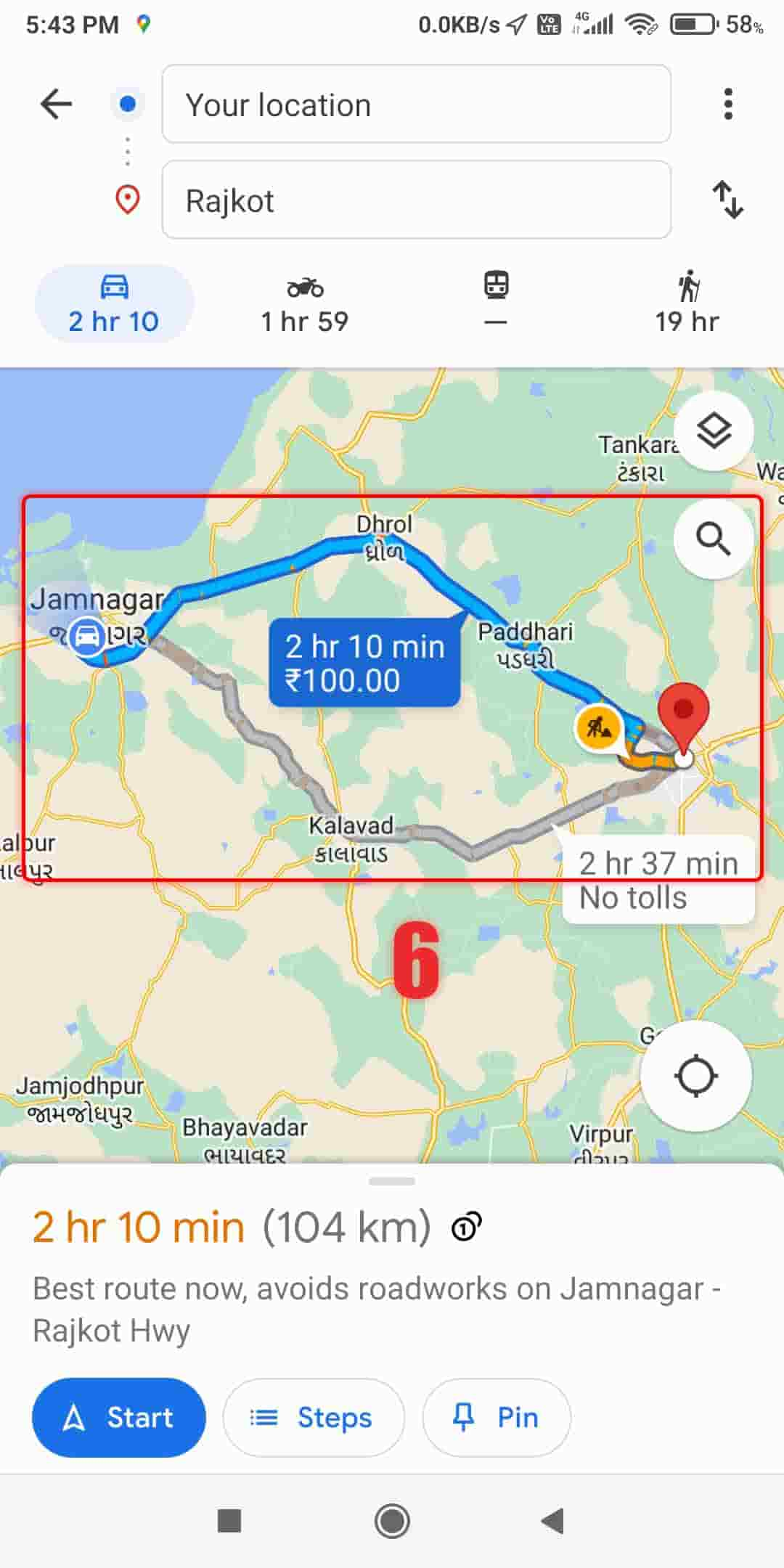
This feature allows you to quickly check the toll prices for roads and bridges, helping you plan your trip and manage your expenses. You can also add a Google Traffic widget to see the traffic in your area right from your device’s home screen.
How to Avoid Toll Roads
If you’d rather not take toll roads, Google Maps can guide you. Here’s how:
Step 1: Tap on your route to see the directions for your journey.
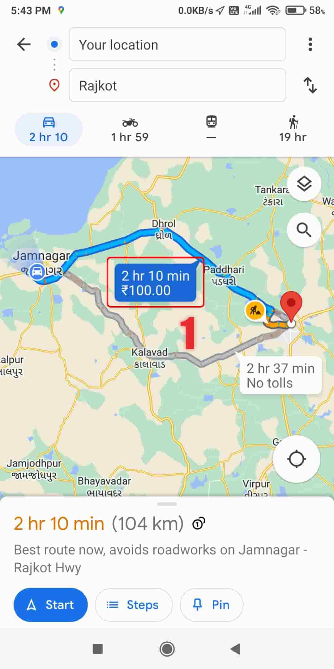
Step 2: Look for any toll roads on the route and tap on “Tolls” to see the prices.
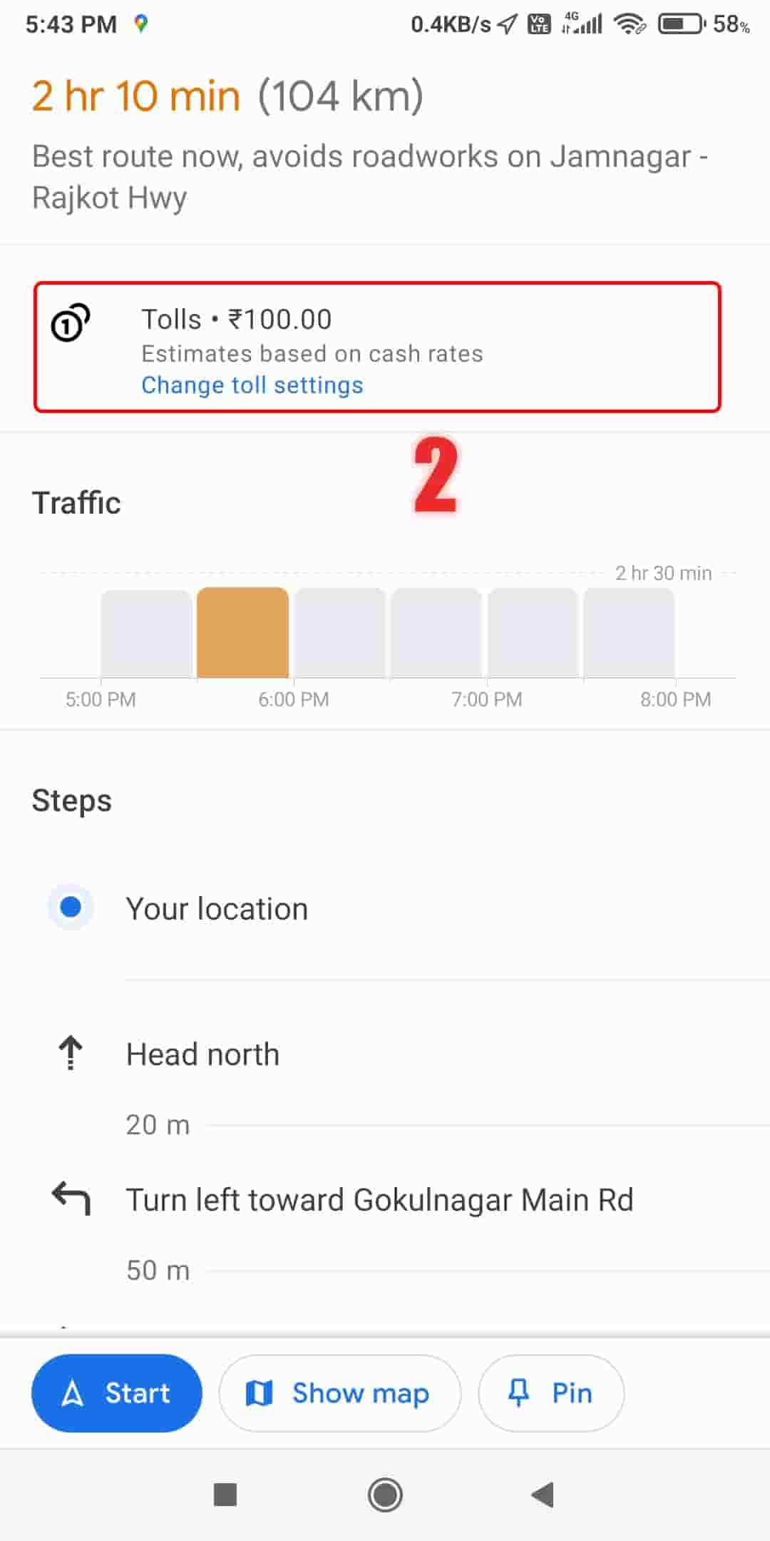
Step 3: A menu will pop up on the screen, select “Driving options”.
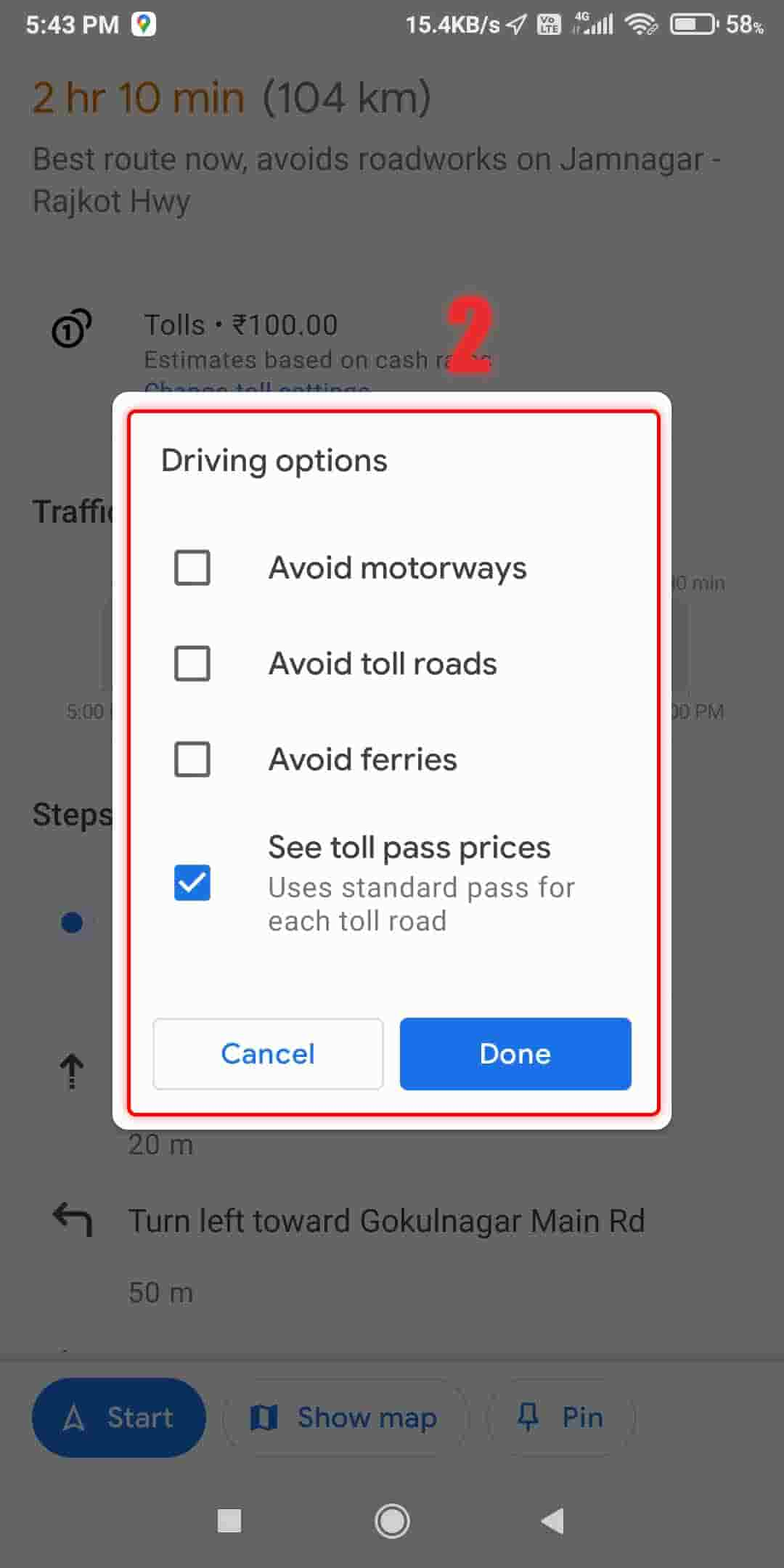
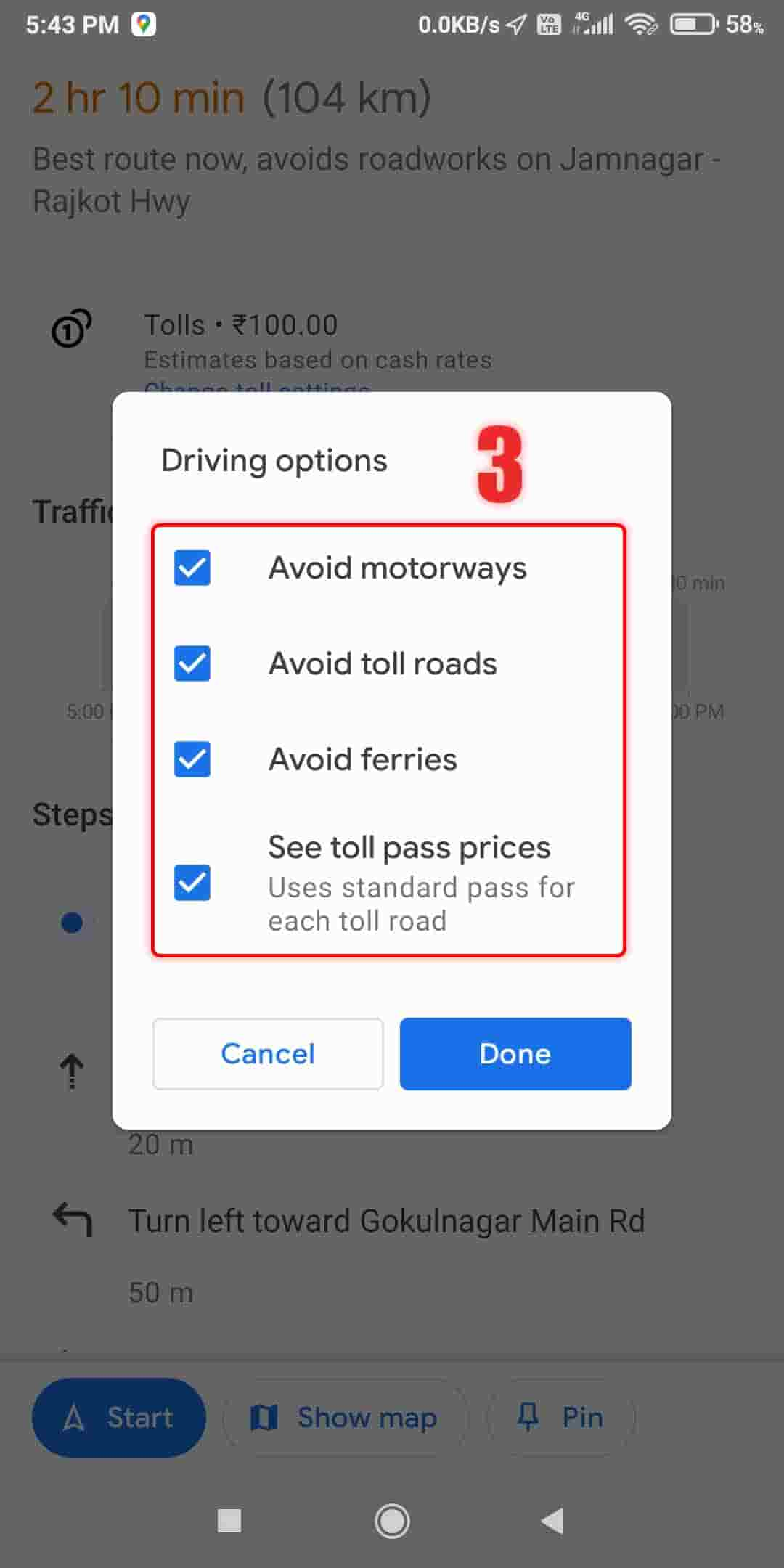
Step 4: Switch on any or all of the three options provided.
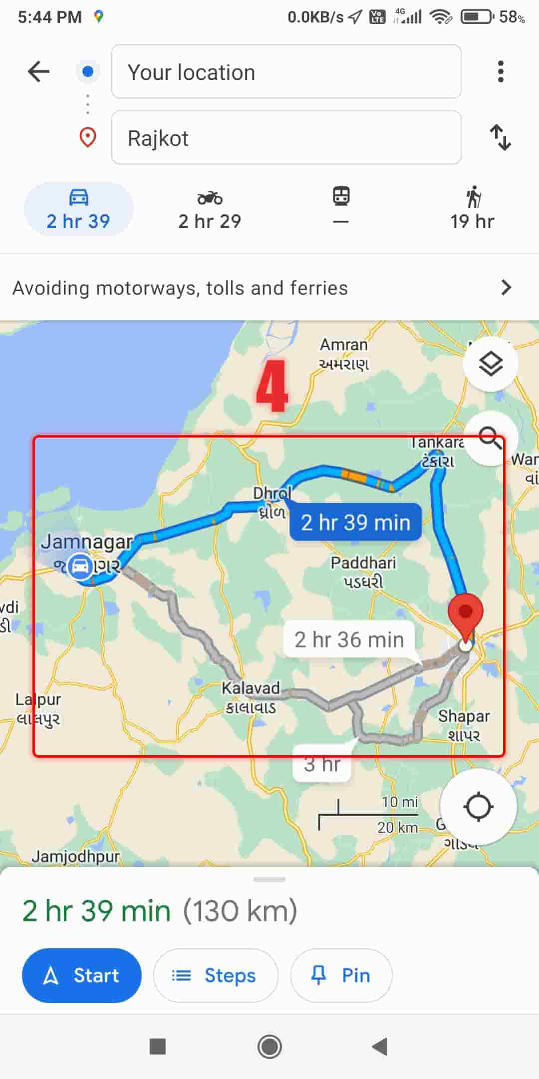
Step 5: After choosing your preferred option, you’ll see the route without any toll roads.
And that’s it! Using Google Maps to check toll prices is a simple and effective way to save time and money when driving on toll roads. So, next time you’re planning a trip, remember to check the toll prices on Google Maps before you hit the road.

